 Zambezi River Tours
Zambezi River: Facts, Wildlife and How to See It at Victoria Falls
The Zambezi river is the fourth-longest river in Africa and the reason Victoria Falls exists. It rises on a high plateau in Zambia, runs about 2,574 km to the Indian Ocean, and passes through six countries on the way. Most visitors meet it at Victoria Falls, on the border of Zimbabwe and Zambia, where the calm upper river carries sunset cruises and the Batoka Gorge below the falls carries some of the best white water in the world. This guide covers where the Zambezi flows, what lives in it, why swimming is a bad idea almost everywhere, and how to get onto the water. To pick a trip, start with the all the Victoria Falls river trips comparison.
Quick answer The Zambezi at a glance
The Zambezi river is about 2,574 km (1,599 mi) long by the most commonly cited figure, which makes it the fourth-longest river in Africa after the Nile, Congo and Niger. It rises in northwestern Zambia, flows or forms borders through six countries (Zambia, Angola, Namibia, Botswana, Zimbabwe and Mozambique), and empties into the Indian Ocean through a delta in Mozambique. Victoria Falls sits at the boundary between its upper and middle reaches. Sources disagree on the exact length, so some references print figures closer to 2,700 km or even 3,540 km.
Key takeaways
- See the calm upper river on a Zambezi River cruise above the falls
- Run the Grade 4-5 rapids on a Batoka Gorge rafting trip
- Compare all the tours side by side in one table
- Jump to what lives in the Zambezi
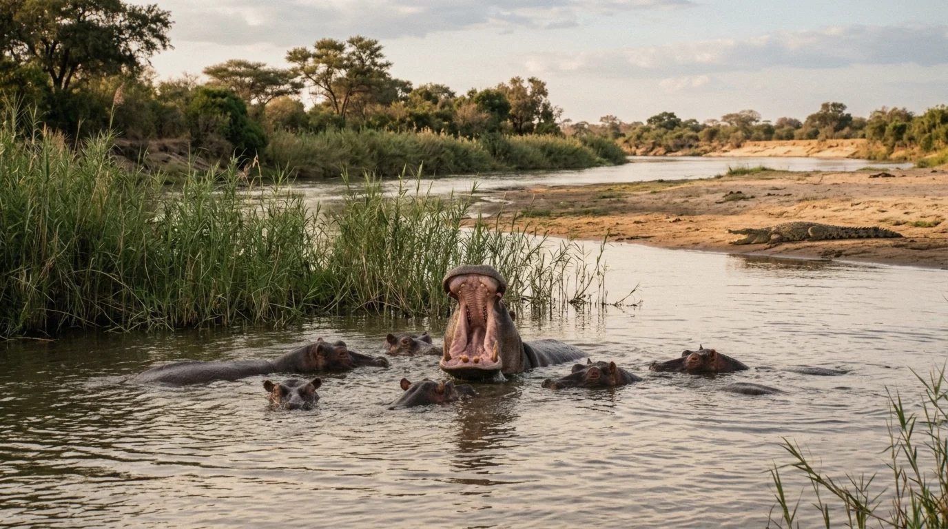
Hippos and Nile crocodiles on the upper river.
Where the Zambezi Flows, Source to Sea
The Zambezi crosses or borders six countries between its source on a Zambian plateau and the Indian Ocean. Here is the river in order.
The Source near Kalene Hill
The Zambezi rises from a marshy dambo wetland near Kalene Hill in Zambia's Ikelenge District, in North-Western Province, at about 1,500 m (4,900 ft) above sea level. That is close to where Zambia, Angola and the DR Congo meet. The area around the source is protected as a national monument, a forest reserve (Zambezi Source National Forest) and an important bird area.
In answer to the common question of which country the Zambezi is in: it rises in Zambia, but it belongs to six. It flows through eastern Angola for about 240 km, then re-enters Zambia, and it crosses or forms the border of Namibia, Botswana, Zimbabwe and Mozambique before reaching the sea.
- Country of source: Zambia (Ikelenge District)
- Countries on the course: Zambia, Angola, Namibia, Botswana, Zimbabwe, Mozambique
- Source elevation: about 1,500 m (4,900 ft)
The Upper Zambezi
From the source the river runs through Angola and back into Zambia, passes over Chavuma Falls and the rapids above it, and spreads across the Barotse Floodplain. Near Chavuma it is nearly 400 m wide in the rainy season. The floodplain is the defining feature of the upper river: in flood it reaches a width of about 25 km and shapes the landscape and Lozi culture for more than 200 km downstream. Each year the Lozi king moves by barge from the dry-season capital at Lealui to high ground at Limulunga, a ceremony called the Kuomboka, which means "to move out of the water".
The upper Zambezi ends at Victoria Falls, which marks the boundary between the upper and middle river. The Chobe River joins at Kazungula, where the borders of Zambia, Zimbabwe, Botswana and Namibia converge within about 150 m of each other.
- Chavuma Falls ends the upper rapids
- Barotse Floodplain: up to 25 km wide in flood
- Kazungula quadripoint, about 70 km west of Livingstone
The Middle Zambezi and the Batoka Gorge
Below Victoria Falls the river drops into the Batoka Gorge and runs east for about 200 km between basalt walls as little as 20 to 60 m apart, in hills 200-250 m high. It falls about 250 m over that stretch before reaching Lake Kariba. This is the whitewater section that rafting trips run, graded up to Class V. Beyond Kariba the river continues to Lake Cahora Bassa in Mozambique, at the site of the dangerous Kebrabassa rapids that drowned when the dam filled.
The middle Zambezi ends there.
- Batoka Gorge: about 200 km, a drop of about 250 m
- Rapids graded up to Class V, Grade VI considered unrunnable
- Middle river ends at Lake Cahora Bassa
The Lower Zambezi and the Delta
The lower Zambezi runs about 650 km from Cahora Bassa to the Indian Ocean and is navigable, though shallow in the dry season. For most of that stretch it is 5-8 km wide, narrowing to as little as 200 m only at Lupata Gorge, 320 km from the mouth. Near the coast it splits into a delta with channels named Kongone, Luabo and Timbwe, all obstructed by sandbars. The Chinde mouth, with a minimum depth of 2 m at the entrance and 4 m further in, is the navigable branch. The delta is today about half as broad as it was before the Kariba and Cahora Bassa dams flattened the seasonal floods.
The table below breaks the whole course into five sections, compiled from Wikipedia and Britannica summaries of the river.
| Section | Stretch | What is there |
|---|---|---|
| Source | Kalene Hill area, Ikelenge District, Zambia, about 1,500 m elevation | Protected wetland, forest reserve, bird area |
| Upper Zambezi | Source through Angola, back through Zambia, to Victoria Falls | Chavuma Falls, Barotse Floodplain (flood up to 25 km wide), Kazungula quadripoint |
| Middle Zambezi | Victoria Falls to Lake Cahora Bassa | Batoka Gorge (about 200 km, 250 m drop), Lake Kariba, Lake Cahora Bassa |
| Lower Zambezi | Cahora Bassa to the coast, about 650 km | Navigable channel 5-8 km wide, Lupata Gorge narrows to about 200 m |
| Delta | Mozambique coast | Kongone, Luabo, Timbwe and Chinde mouths, sandbars |
Victoria Falls, Kariba and Cahora Bassa
Three features interrupt the river's course more than any others: the falls themselves and the two great hydroelectric dams.
Victoria Falls: the break between upper and middle
Victoria Falls marks the boundary between the upper and middle Zambezi. The falls stretch 1,708 m across and drop 108 m (354 ft) into a basalt chasm. Average annual flow over the edge is about 1,088 cubic meters per second, with the flood peak in April and the low point around November, when the flow drops to roughly a tenth of the April volume.
The local Lozi name Mosi-oa-Tunya means "the smoke that thunders", and the falls were made a UNESCO World Heritage Site in 1989. The Victoria Falls Bridge, completed in April 1905, was the first crossing built over the river.
Kariba and Cahora Bassa
Below the gorge the Kariba Dam, completed in 1959 and officially opened in 1960, holds back Lake Kariba, 128 m of concrete forming one of the largest man-made lakes in the world. Reported surface area ranges from 5,400 to 5,580 sq km depending on the source, and its storage capacity of about 185 cubic km makes it the world's largest reservoir by volume. The lake is about 226 km long and up to 40 km wide, and it supports a commercial fishing industry.
Further downstream, Mozambique's Cahora Bassa Dam began filling in December 1974, though some sources date full completion to 1979 when the last of five generators was installed. Its lake covers about 2,739 sq km, roughly 240 km long and 31 km at its widest. Filling it in a single flood season instead of the recommended two years cut downstream flow so sharply that mangrove coverage fell by 40% and the prawn catch off the river mouth fell by 60%.
Kariba and Cahora Bassa are still the two main hydroelectric sources on the river, supplying Zambia, Zimbabwe, Mozambique and South Africa. Two smaller stations sit at Victoria Falls and at Zengamina in Zambia. The table gathers the key figures from the published sources.
| Structure | Key figures | Notes |
|---|---|---|
| Victoria Falls | 108 m high, 1,708 m wide, about 1,088 cu m/s average flow | Boundary of upper and middle river, UNESCO site 1989 |
| Kariba Dam | Completed 1959, opened 1960, 128 m high | Lake of 5,400-5,580 sq km, about 185 cu km capacity, 226 km long |
| Cahora Bassa Dam | Filling began December 1974, some sources date completion 1979 | Lake about 2,739 sq km, about 240 km long |
| Smaller stations | Victoria Falls and Zengamina (Zambia) | Minor hydroelectric sites |
What Lives in the Zambezi
The Zambezi's calm stretches and floodplains carry some of the densest large-animal populations in southern Africa.
Hippos and crocodiles
Hippopotamuses are abundant along most of the calm stretches of the river, alongside large Nile crocodile populations. Both are the reason swimming in the Zambezi is a bad idea, and both are easy to see from the water. Both are commonly seen from sunset cruises above Victoria Falls.
Zambia Tourism lists hippo and crocodile as the river's signature animals, and the same species are commonly seen on the upper Zambezi inside Zimbabwe's Zambezi National Park.
Fish, birds and the big land animals
The Zambezi supports several hundred fish species. The best known are the tigerfish, a prized game fish, plus cichlids fished heavily for food, catfish and yellowfish. Communities along the river fish it for food and income, and game fishing for tigerfish and bream is a major tourist activity, especially between Mongu and Livingstone and around Lake Kariba.
Riverine woodland supports buffalo, zebra, giraffe and elephant, which come down to drink at dusk. The birdlife is one of the river's biggest draws: heron, pelican, egret, lesser flamingo and African fish eagle all appear in large numbers. More than 400 bird species have been recorded in and around Zambezi National Park alone.
What about sharks?
The bull shark is sometimes called the "Zambezi shark" because the species is known to travel far up rivers in fresh water. The name is shared, though. Documented reports of bull sharks confirmed in the Zambezi channel itself are limited, and most detailed research and records for southern Africa focus on the coastline rather than the river.
No confirmed case of a bull shark near Victoria Falls was found in the published sources. Any swimmer's real concerns in this part of the river are crocodiles, hippos and currents, not sharks.
Can You Swim in the Zambezi River?
Almost always no, and the reasons are written into the river's ecology.
Why swimming is not safe
No, you should not swim in the Zambezi. The calm water that makes the cruises so pleasant is exactly the habitat Nile crocodiles and hippopotamuses prefer, and both animals attack and kill people in the water across Africa. Crocodiles hunt from below the surface. Hippos, which look docile on a sandbank, are territorial and aggressive in the water. The local Tonga name for the river, Kasambabezi, means "only those who know the river can bathe in it", which is as clear a warning as any guidebook.
Below Victoria Falls there is a second reason: the river drops into the Batoka Gorge and becomes Grade 4-5 whitewater with strong currents and undertows. Casual swimming in the gorge is dangerous even where crocodiles are less of a factor, which is why rafting trips outfit everyone with helmets, life jackets and a safety kayaker.
The controlled exception: Devil's Pool
There is one organised exception. On the Zambian side, Devil's Pool at the lip of Victoria Falls on Livingstone Island lets you swim to within arm's reach of the edge, in a natural rock pool. It is only open when water levels are low enough, roughly mid-August through mid-January, with a guided operator, and it closes during high water from roughly March or April to May or June depending on that year's flood.
Listed pricing starts around $90 for a breakfast trip and runs to about $158 for a lunch trip including alcohol. Outside a guided, controlled spot like this, stay out of the water.
- Open water: no, crocodiles and hippos make it unsafe
- Batoka Gorge: no, Grade 4-5 rapids and undertows
- Devil's Pool: yes, guided, low water only, roughly mid-August to mid-January
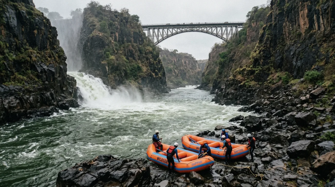
Below the falls the river enters the Batoka Gorge.
The Name and the History
The river's name means something close to what it plainly is, and its European history starts with a case of mistaken geography.
What does Zambezi mean?
The most widely repeated explanation, per Britannica, is that Zambezi means "Great River" in the Tonga language. David Livingstone recorded the local Lozi name as Leeambye, meaning "large river" or "river par excellence", and noted regional variants including Luambeji, Luambesi, Ambezi and Ojimbesi, all with a similar sense of "the main drain of the country". The Tonga also called the river Kasambabezi, meaning "only those who know the river can bathe in it".
Two other theories exist and sources differ: one derives the name from a Bantu word for fish, making it roughly "river of fish", another ties it to the Bisa people who lived near a great lake to the north.
Da Gama, Livingstone and the mapped river
The first European on the Zambezi was the Portuguese explorer Vasco da Gama, who in January 1498 anchored at a river mouth he named Rio dos Bons Sinais, the River of Good Omens, now the Quelimane. David Livingstone first heard of the great waterfall in 1851. His expedition to find it set out in 1855, and he reached Victoria Falls by canoe on 16-17 November 1855, guided by local Kololo and Lozi paddlers who had camped with him the previous night on an island upstream.
His later Zambezi Expedition of 1858-60, with John Kirk, ascended the river from the Kongone mouth back to the falls and traced the Shire River to Lake Malawi. Livingstone had hoped to open the river to steamboat navigation, but the Cahora Bassa rapids defeated the plan. Local Lozi folklore holds that a river spirit called Nyami Nyami brings water for crops and fish to eat, which is why the river is called "the river of life".
How to See the Zambezi at Victoria Falls
The falls split the visitor experience in two. Above them the river is wide, calm and made for boats. Below them it is whitewater.
Cruises above the falls
Sunset cruises run on the upper Zambezi upstream of Victoria Falls town. The cheapest way onto the water is the 2-hour sunset cruise on the three-deck Zambezi Explorer, from $69 with Pure Africa, with canapés and drinks included and a $12 park fee paid at check-in. The dinner cruise from the same operator is a 3-hour evening with a four-course dinner cooked on board and drinks included, from $110.
Boats typically board around 16:30 in summer and 16:00 in winter, and hippos and crocodiles are regularly seen from the deck. If you want to compare every cruise, rafting trip and falls tour in one table, see the tour comparison.
Rafting below the falls
Below Victoria Falls the river runs Grade 4 and 5 rapids through the Batoka Gorge. From the Zimbabwe side, Shockwave's full-day rafting costs from $180 with lunch, an open bar and all gear, with a minimum age of 13 on that listing. From Livingstone, Maano's half-day trip runs rapids 14 to 25 for from $140, with photos, video and lunch included, a $10 park fee and the listing is not suitable for children under 12.
General operator guidance sets the minimum age at 15 with parental consent for under-18s, so check the specific listing before booking. Low-water season, roughly August to early December, is the most technical and most popular window.
The river by land and air
You do not have to be on the water. Zambezi National Park, upstream of the falls in Zimbabwe, covers about 56,000 hectares along the river, with game drives and riverside viewing of elephant, buffalo and more than 400 bird species. For the falls themselves, a guided tour of both sides costs from $63 plus entry fees of $58 in Zimbabwe and $20 in Zambia per the listing. Helicopter flights over the falls run about 12-15 minutes, with an extended 25-minute option over the gorges.
The table compares the five ways most visitors get onto or next to the river, with prices as printed on each listing.
| Option | Where | From price | Duration |
|---|---|---|---|
| Sunset cruise (tour 2) | Upper Zambezi above the falls | $69 | 2 hours |
| Dinner cruise (tour 1) | Upper Zambezi above the falls | $110 | 3 hours |
| Full-day rafting (tour 5) | Batoka Gorge below the falls | $180 | 6 hours |
| Half-day rafting (tour 6) | Batoka Gorge rapids 14-25 | $140 | 4 hours |
| Guided falls tour (tour 7) | Both sides, bridge crossing | $63 | 6 hours |
Watch Before You Go
A third-party video, embedded from YouTube. We have no relationship with its creator.
Zambezi River: Questions
Why can't you swim in the Zambezi river?
The calm stretches hold large populations of Nile crocodiles and hippopotamuses, both of which attack people in the water. Below Victoria Falls the river becomes Grade 4-5 whitewater with strong currents and undertows. The one safe swim is Devil's Pool, a guided spot at the lip of the falls open only at low water.
In which country is the Zambezi river?
It rises in Zambia, but it crosses or borders six countries: Zambia, Angola, Namibia, Botswana, Zimbabwe and Mozambique. Victoria Falls sits on the Zimbabwe-Zambia border, which is where most visitors meet the river.
What does Zambezi mean in English?
The most widely repeated explanation is "Great River" in the Tonga language, per Britannica. Livingstone recorded the Lozi name as Leeambye, meaning "large river", and other theories derive the name from a Bantu word for fish or from the Bisa people. Sources differ on the true origin.
What animals live in the Zambezi river?
Hippos and Nile crocodiles are abundant in the calm stretches, and the river supports several hundred fish species including tigerfish, catfish and cichlids. Riverine woodland brings elephant, buffalo, zebra and giraffe to its banks, and birdlife includes African fish eagles, herons and pelicans. See what lives in the Zambezi for detail.
How long is the Zambezi river?
About 2,574 km (1,599 mi) by the most commonly cited figure, making it the fourth-longest river in Africa. Sources disagree, with some printing roughly 2,700 km and Britannica about 3,540 km, so treat any exact figure as an estimate. The course section shows where the length is measured.
Where does the Zambezi start and end?
It starts from a marshy wetland near Kalene Hill in Zambia's Ikelenge District at about 1,500 m above sea level, and ends in a delta on the Indian Ocean coast of Mozambique, with the navigable Chinde mouth as the main channel. The river course table sets out each section.
Can you swim in Devil's Pool all year?
No. Devil's Pool on Livingstone Island is only open at low water, roughly mid-August through mid-January, and closes during the high-water flood from roughly March or April to May or June depending on the year. Bookings run through guided Livingstone Island trips.